Science explained · Earth & Environment
How Do Clouds Stay in the Sky?
How can hundreds of tonnes of liquid water remain overhead when every droplet feels gravity?

Explore the sections in this article
The white part is condensed water
Water vapor is an invisible gas. What makes most clouds visible is light scattered by liquid droplets or ice crystals large enough and numerous enough to redirect sunlight. Steam-like white mist over a kettle is also condensed droplets; the true vapor close to the spout is invisible.
Cloud air usually contains much more ordinary nitrogen and oxygen than condensed water. A representative liquid-water content might be around 0.5 grams per cubic meter, though values vary widely by cloud type and location. The droplets are suspended in and transported by that air rather than packed like a lake.
Their combined optical effect is large because there are so many scattering surfaces. The cloud's sharp-looking edge often marks where humidity and temperature allow droplets to survive, not a membrane enclosing them.
Condensation needs a microscopic foothold
As rising air expands in lower pressure, it cools. When its water-vapor content is high enough relative to temperature, the air becomes supersaturated with respect to a droplet surface. Vapor molecules can join liquid water.
In the atmosphere, condensation usually begins on aerosol particles called cloud condensation nuclei: sea salt, sulfate, organic material, dust and other microscopic matter. The particle lowers the barrier to forming a stable droplet. Without nuclei, a perfectly clean parcel can remain supersaturated beyond the ordinary threshold.
A nucleus does not “turn into” all the water. It is the seed around which vapor accumulates. Aerosol chemistry and size affect which particles activate and how many droplets share the available water.
A cloud droplet is far smaller than a raindrop
A typical cloud droplet radius is around 10 micrometers, or 0.01 millimeter. A raindrop radius can be hundreds to thousands of micrometers. Radius sounds like a linear change, but mass scales with radius cubed.
If one droplet's radius grows from 10 μm to 1 mm—a factor of 100—its volume and, at equal density, mass increase by 100³ = 1,000,000. It cannot reach that size by adding one equally tiny neighbor; it would require the volume of roughly a million 10 μm droplets.
Real precipitation growth uses a distribution of sizes and several mechanisms, but the cube explains why “the droplets simply get a little heavier” hides an enormous transition.
Drag catches a small droplet almost immediately
Gravity pulls the droplet downward. As it moves through air, viscous drag pushes upward. For a sufficiently small spherical droplet in slow flow, Stokes' law gives terminal speed:
vₜ = 2r²(ρw − ρa)g / 9μ
Use radius r = 10 × 10⁻⁶ m, water density ρw ≈ 1000 kg/m³, air density ρa ≈ 1.2 kg/m³, gravity g = 9.81 m/s², and air dynamic viscosity μ ≈ 1.8 × 10⁻⁵ Pa·s. The result is about:
vₜ ≈ 0.012 m/s, or 1.2 cm/s.
That matches the NWS educational scale of roughly 1.3 cm/s for an average cloud droplet. The calculation assumes an isolated sphere, still air and the Stokes regime. Larger drops deform and require different drag relations.
“Suspended” rarely means motionless
At 1.2 cm/s, an isolated droplet in perfectly still air would settle about 0.012 × 3600 = 43 meters in one hour. Clouds are not still. Even a gentle upward air velocity of 0.1 m/s exceeds that settling speed by nearly an order of magnitude.
Turbulence gives droplets fluctuating upward, downward and sideways velocities. Some settle through rising air; others are carried upward relative to ground. Their inertia is low enough that small droplets follow air motion closely, though not perfectly.
Calling them “suspended” is useful at human scale but can imply static support. The more accurate picture is continuous relative motion: the droplet falls slowly through an air parcel that may itself rise faster.
The cloud outline is a phase boundary in motion
Mix dry environmental air into cloud air and droplets can evaporate. Lift humid air and new droplets can activate. Sunlight, radiative cooling, entrainment and turbulence change the local balance. The water molecule visible in one droplet may become vapor and later condense somewhere else.
This is why a cloud can appear nearly fixed over a mountain while air flows through it. Orographic lifting continuously cools incoming moist air on the windward side; droplets form in a favored region and evaporate downstream. The pattern persists while its material changes, like a standing river wave.
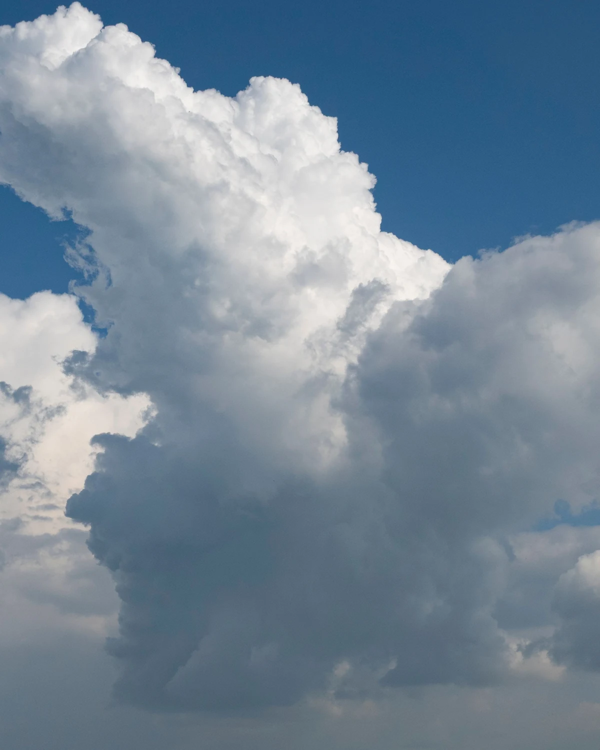
Even a drifting fair-weather cumulus has a life cycle. Its visible turrets mark buoyant updrafts; edges fray where entrainment dilutes them; precipitation and downdrafts can weaken the source.
Hundreds of tonnes do not make a compact falling block
Consider an illustrative cubic kilometer of cloud: 10⁹ m³. At a liquid-water content of 0.5 g/m³, the liquid mass is:
10⁹ m³ × 0.5 g/m³ = 5 × 10⁸ g = 5 × 10⁵ kg, or 500 tonnes.
That headline is real as an order-of-magnitude example, but it is often used badly. The same volume contains roughly a billion kilograms of air, depending on altitude and conditions. The liquid is dispersed among droplets across the entire cubic kilometer. There is no 500-tonne water bag pulling on one support point.
Buoyancy concerns the density of the cloudy air parcel relative to its environment, including temperature and water loading. Individual particle settling is a separate, simultaneous problem.
Warmth can outweigh water loading
Adding condensed water increases a parcel's mass, while warming and water vapor can reduce its density relative to surrounding dry air. Latent heat released during condensation helps keep a convective parcel buoyant, but carrying liquid and ice exerts water loading that opposes ascent. Entrainment of cooler, drier environmental air can erode buoyancy further.
These competing terms explain why “clouds float because they are less dense than air” is incomplete. A cloudy parcel can be positively buoyant, neutrally buoyant or sinking. Its droplets still have their own terminal velocities relative to that parcel. A downdraft cloud has not become heavier as a single object; the air–particle mixture has developed downward motion and altered buoyancy.
Meteorologists estimate buoyancy from temperature and moisture profiles and represent condensate loading in equations of motion. Measuring it directly is difficult because a probe samples one point inside a turbulent field. Radar vertical velocity, aircraft motion and thermodynamic sensors each add a different piece.
More condensation nuclei can delay or relocate rain
If the same available liquid water is divided among more activated nuclei, the mean droplet can be smaller. Smaller droplets collide less efficiently, so warm-rain formation may be delayed. The cloud can also become optically brighter because more droplets provide more scattering area.
That is the basis of the aerosol–cloud interaction often called the Twomey effect, but real precipitation responses are not one-direction switches. Delayed warm rain may let a convective cloud grow deeper, where freezing releases more latent heat and ice processes change precipitation. Aerosols also absorb or scatter sunlight and alter environmental stability.
A ship track or polluted-cloud image is evidence of altered droplet populations under particular conditions, not proof that pollution always stops or increases rain. Climate models struggle with these coupled adjustments because cloud lifetime, organization and background meteorology respond together.
Residence time is a population statistic
Divide a 1,000-meter cloud depth by the 0.012 m/s still-air settling speed and a lone 10 μm droplet would take about 83,000 seconds, or 23 hours, to cross it. That estimate ignores evaporation, turbulence and vertical air motion—precisely the processes that usually end or redirect its life first.
Cloud water residence time therefore cannot be inferred from depth alone. Researchers track size distributions, chemical tracers and model trajectories. A droplet's identity may last minutes while the recognizable cloud pattern persists longer, or the cloud may dissipate before the particle could settle through it.
Warm clouds must bridge a growth bottleneck
Condensation grows activated droplets efficiently to cloud size, then slows because vapor is shared among many droplets and surface curvature/solute effects matter. Reaching raindrop size by condensation alone would generally take too long for observed showers.
In warm clouds, larger droplets fall slightly faster than smaller ones, collide and sometimes coalesce. Once a few collector drops gain an advantage, growth can run away: greater size produces greater fall speed and a larger sweep volume. Turbulence and droplet-size breadth can modify collision rates.
Not every collision merges. Aerodynamic deflection makes very small droplets follow flow around a collector; impacts can bounce, coalesce or break depending on size and conditions. Cloud models therefore represent collision efficiency rather than assuming perfect capture.
Mixed-phase clouds use ice to accelerate growth
At temperatures below freezing, liquid droplets can remain supercooled. If ice crystals coexist, the lower saturation vapor pressure over ice allows vapor to deposit preferentially on ice while nearby droplets evaporate. This is the Wegener–Bergeron–Findeisen process.
Ice crystals also collide and aggregate; falling ice can collect supercooled droplets and become rimed graupel. When particles fall into warmer air they may melt into rain. Which pathway dominates depends on temperature, humidity, vertical motion and particle population.
“Gravity wins” is incomplete because gravity acted from the first moment. Precipitation begins when growth gives particles fall speeds and lifetimes that overcome upward motion and evaporation on the route downward.

Why not every cloud rains
A cloud may be shallow, short-lived or filled with droplets too uniform and small for efficient collision. Dry air below can evaporate falling precipitation into virga. Updrafts may recycle particles. Ice nuclei may be scarce at relevant temperatures. Entrainment can dissolve the cloud before growth crosses the bottleneck.
A dark base does not prove rain reaches the ground. Optical thickness depends on droplet number, size and path length. Polluted clouds can contain more numerous, smaller droplets and appear bright while precipitation response varies with cloud regime.
Forecasting precipitation requires dynamics and microphysics, not one visual sign. A photograph cannot reveal the full vertical particle distribution.
What keeps an ice crystal aloft
Ice crystals are not spheres. Plates, columns, aggregates and rimed particles have different mass-to-area ratios and orientations. Drag can make a broad, light aggregate fall slowly, while compact graupel falls faster. Turbulence changes orientation and relative motion.
Some cirrus crystals sediment appreciably and create fall streaks. If they enter drier air, they sublimate back to vapor. An anvil can spread horizontally because upper-level winds carry crystals away from the updraft that produced them.
Thus “cloud droplets are tiny” is only the warm-cloud half of the answer. Cold clouds need habit-dependent ice fall speeds and deposition/sublimation physics.
How scientists count particles inside a cloud
Aircraft carry optical probes that image or infer particles crossing laser beams. Hot-wire sensors estimate liquid-water content. Radar transmits microwaves and measures returned power and Doppler velocity, which depend strongly on particle size, shape and phase. Lidars and satellites add optical views.
Sampling is difficult. An aircraft crosses only a narrow path; fragile ice can shatter on probe inlets and create false small particles; radar reflectivity weights larger particles strongly. Cloud fields change while being measured.
Laboratory chambers isolate activation and growth. Direct numerical simulations resolve turbulence and droplets over tiny volumes, while weather models parameterize populations too small to track individually. Agreement across scales is an active research problem, not a finished lookup table.
A safe observation: watch a cloud replace itself
From a sheltered location in fair weather, choose a small cumulus feature and compare its edge with a fixed roofline for a few minutes. A turret may grow on one side while another edge evaporates. The recognizable cloud persists even though its outline and material change.
Do not use this during a thunderstorm or as a weather forecast. Never infer aviation safety, storm severity or precipitation timing from a casual view. Official observations and forecasts use instruments and trained analysis.
The useful lesson is visual: cloud identity is a pattern in moving air, not ownership of the same droplets.
The misconception contains one grain of truth
People say updrafts “hold clouds up.” Upward air is indeed important, especially in convective clouds, and can exceed small-particle terminal speeds. But a quiet stratiform cloud can persist with weak mean ascent because droplets settle slowly, turbulence mixes them and condensation replaces losses.
People also say droplets are “too light to fall.” Every droplet has weight and falls relative to still air. Small size makes its terminal velocity slow because weight scales with volume while viscous interaction is effective.
The premium answer needs both statements at once: particles settle, and cloud-scale air/microphysics continually rearrange them.
A cloud is a process with a visible address
The cloud's tonnes of water are real, but the number distracts from distribution. Divide that water among trillions of tiny particles and each responds strongly to drag. Put those particles inside rising, turbulent, humid air and their slow settling becomes one motion among many.
Grow a minority by coalescence, deposition, aggregation or riming and their fall speeds increase. Let dry air mix in and some vanish before reaching the ground. The cloud can lose water downward while forming new water above.
The object in the sky was a process all along. It stays visible at an address where condensation, airflow and particle lifetime overlap, while its contents are always falling through themselves.
Frequently asked questions
Are clouds made of water vapor?
Visible clouds are made mainly visible by liquid droplets and/or ice crystals. Water vapor is present but is itself invisible.
Do cloud droplets fall?
Yes. A typical small droplet settles relative to still air at roughly a centimeter per second. Air motion can carry it upward relative to the ground.
How much does a cloud weigh?
An illustrative cubic kilometer at 0.5 g/m³ liquid-water content contains about 500 tonnes of liquid. It is dispersed through a far larger mass of air, not concentrated in a container.
Why are clouds flat on the bottom?
Rising air can reach its condensation level at a similar altitude across a region, creating a relatively flat base. Terrain, mixing and moisture make real bases uneven.
Why do some clouds disappear without raining?
Mixing with drier air and warming can evaporate droplets. The cloud may also lack time or microphysical pathways to grow precipitation-sized particles.
What turns cloud droplets into rain?
Warm clouds use collision–coalescence; mixed-phase clouds also use vapor deposition on ice, aggregation and riming. Growth increases fall speed and survival.
Can a cloud fall to the ground?
Fog is essentially a cloud at ground level. A descending cloud base or upslope terrain can also surround an observer, but the cloud remains a particle-laden air region.
Are darker clouds heavier?
Darkness usually indicates greater optical thickness or less illumination, not a direct scale reading of mass. Droplet size, number, depth and lighting all matter.
Sources & further reading
This explainer was prepared through desk research using the sources below; established findings are distinguished from open questions in the text. See our editorial methodology.
- National Weather Service training, Cloud Development — condensation nuclei, typical cloud-droplet terminal speed and distinction between condensation and precipitation.
- NWS, Cloud Precipitation Processes — droplet growth, terminal velocity, warm- and cold-cloud pathways.
- NASA Earth Observatory, Aerosols: Tiny Particles, Big Impact — cloud condensation nuclei, droplet number/size and optical consequences.
- Pruppacher & Klett, Microphysics of Clouds and Precipitation, 2nd ed. — foundational droplet activation, growth, drag and ice microphysics.
- Grabowski & Wang, “Growth of Cloud Droplets in a Turbulent Environment,” Annual Review of Fluid Mechanics 45 (2013) — condensation/collision bottleneck and turbulence research.
- Ayala, Rosa, Wang & Grabowski, “Effects of turbulence on the geometric collision rate of sedimenting droplets. Part 1: Results from direct numerical simulation,” New Journal of Physics 10 (2008) — direct numerical simulations of 10–60 μm droplets and bounded collision-kernel enhancement.
- Morrison et al., “Confronting the Challenge of Modeling Cloud and Precipitation Microphysics,” Journal of Advances in Modeling Earth Systems 12 (2020) — model/observation scale gap and microphysical parameterization uncertainty.
- NASA Earth Observatory, Changing Our Weather One Smokestack at a Time — condensation nuclei and warm/mixed-phase precipitation explanation.
Spotted an error? We correct verified mistakes promptly — email contact@flashscience.org.
Continue exploring