Science explained · Earth & Environment
How Does a Tornado Form?
Why do many storms rotate kilometers above the ground while only a few concentrate that spin at the surface?
Explore the sections in this article
The atmosphere begins with ingredients, not a funnel
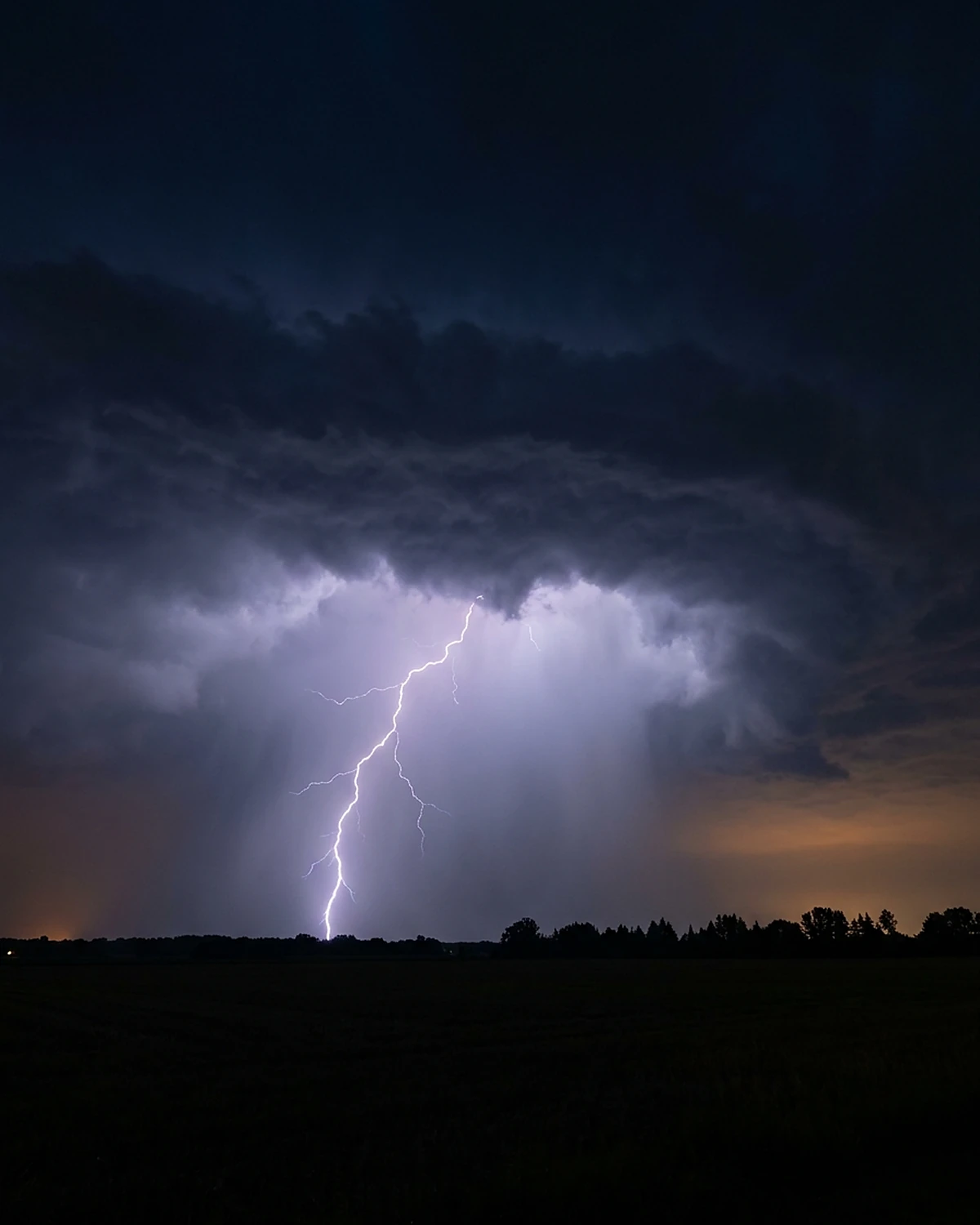
A severe convective storm needs moisture, instability and lift. Moisture supplies water vapor. Instability means a lifted parcel can remain buoyant relative to its environment. A front, dryline, terrain or other convergence can initiate ascent.
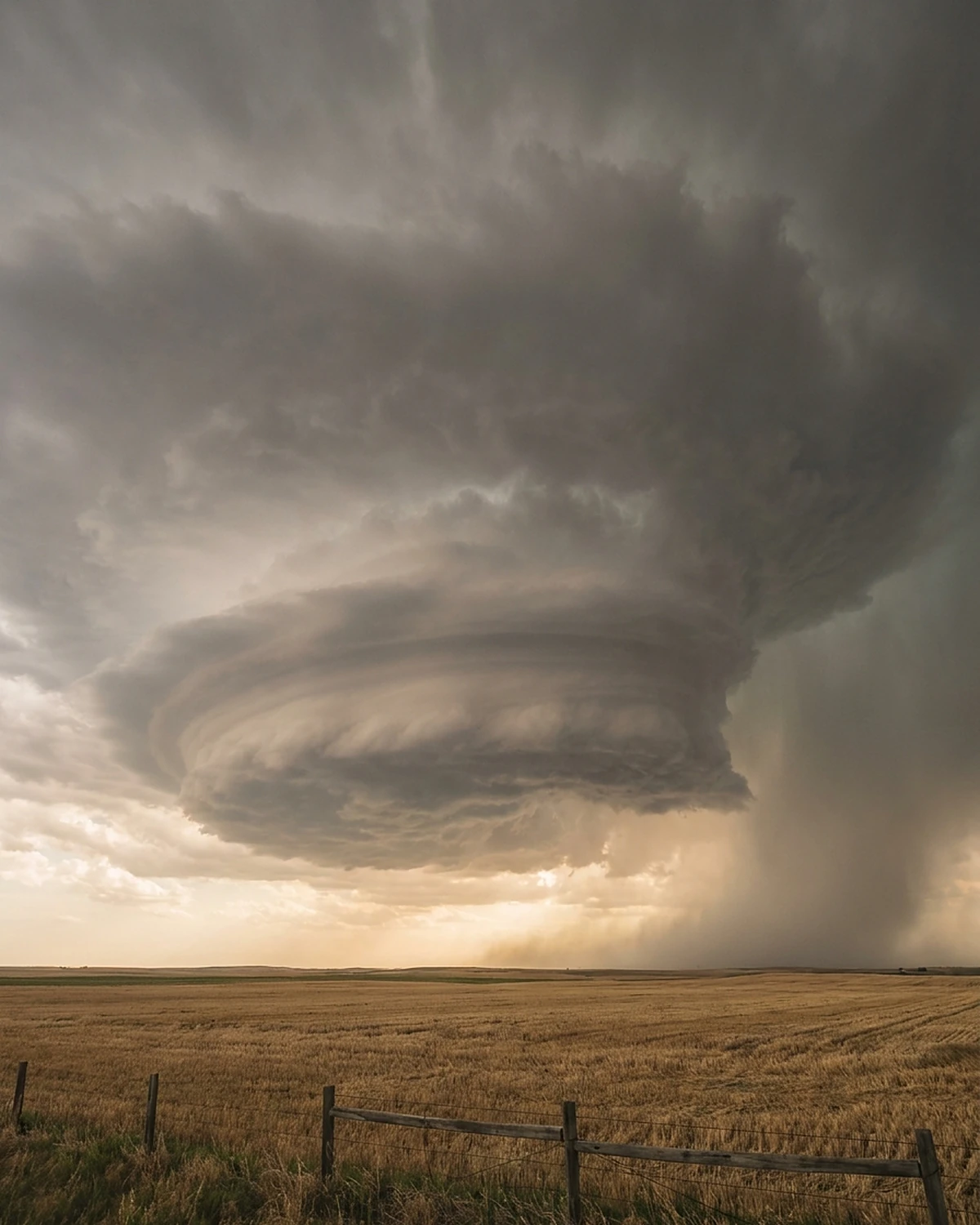
Those ingredients can produce an ordinary thunderstorm. To organize a long-lived rotating supercell, vertical wind shear is especially important: wind speed and/or direction changes with height. The storm's updraft interacts with that environmental profile and can split into rotating branches.
No threshold guarantees a tornado. Forecast indices combine measures of buoyancy and shear to describe environments, not individual-storm destiny. Storm initiation, boundary interactions and internal microphysics introduce uncertainty even on a favorable day.
Wind shear creates horizontal vorticity
Imagine wind near the ground moving east slowly while wind several kilometers up moves east faster. The top of an initially upright paddle wheel is pushed more strongly than the bottom, producing a horizontal roll. In fluid dynamics, the local tendency to rotate is described by vorticity.
Real atmospheric shear includes direction change and storm-relative flow; the paddle wheel is a mental model, not literal rolling tubes visible in air. The horizontal vorticity can be aligned with or across the air entering a storm. Streamwise vorticity is especially effective at producing a rotating updraft.
Earth's rotation helps shape large weather systems, but the Coriolis force does not directly spin a bathtub-size tornado into existence. Storm-scale shear and baroclinic generation dominate the immediate mechanism.
An updraft tips and stretches rotation
As buoyant air rises, vertical velocity changes across the horizontal vortex. One side is lifted more than another, tilting horizontal vorticity into the vertical. Convergence into the updraft then stretches rotating air vertically.
Stretching intensifies vertical vorticity in much the way a figure skater spins faster when mass moves inward, though a storm is an open fluid system continually exchanging air. The result can be a mesocyclone: an updraft-scale rotation commonly several kilometers across.
Dynamic pressure perturbations around the rotating updraft help it persist and deviate from the mean wind. Rain and hail are swept around the circulation, producing radar structures such as a hook echo. A hook is evidence of organized storm flow, not the tornado itself.
Rotation aloft cannot simply be pushed into the floor
Suppose vertical vorticity exists only above the ground and a downdraft carries it downward. At the rigid surface, vertical motion must go to zero. Purely descending an upright vortex would not automatically produce the required intense vertical rotation at the boundary.
The near-ground problem involves vorticity that is generated, tilted and rearranged along air-parcel paths. Horizontal temperature and density gradients—baroclinicity—can generate horizontal vorticity within storm outflow. Downdrafts can transport air carrying vorticity toward the surface, where it is tilted into vertical components and swept toward the updraft.
This is why modern explanations emphasize trajectories and budgets rather than a cartoon mesocyclone reaching down like a drill bit.
The rear-flank downdraft can help or hinder
Air descending around the back side of a supercell is called the rear-flank downdraft, or RFD. Evaporative cooling, precipitation loading and dynamically driven pressure gradients can contribute. The RFD wraps air around the low-level circulation and helps create sharp gradients near the updraft.
Field studies connect tornadogenesis with the RFD's thermodynamic character and geometry. Outflow that is extremely cold and negatively buoyant can undercut the updraft, pushing the lifting air away from surface rotation. Air that is less cold may be more readily lifted and stretched.
“An RFD makes a tornado” is too simple. Nontornadic supercells also have rear-flank downdrafts. Forward-flank boundaries and other storm-generated vorticity can matter. The decisive arrangement changes over minutes and hundreds of meters—scales difficult to sample.
Stretching can turn broad rotation into a narrow vortex
For an idealized vortex with conserved circulation Γ = 2πrv, reducing radius while keeping circulation constant raises tangential speed. If radius contracts from 1,000 m to 100 m, a factor of 10, the toy model gives a tenfold speed increase.
Area falls by 100, and vertical vorticity can intensify strongly if a convergent updraft stretches the column. Real tornadoes exchange momentum, experience friction, contain multiple vortices and have pressure-gradient forces; circulation is not perfectly conserved along a simple ring.
The calculation explains concentration, not initiation. A storm still needs low-level vertical vorticity in the right place and air buoyant enough to rise. Stretching cannot amplify zero.
The condensation funnel is a pressure-and-humidity marker
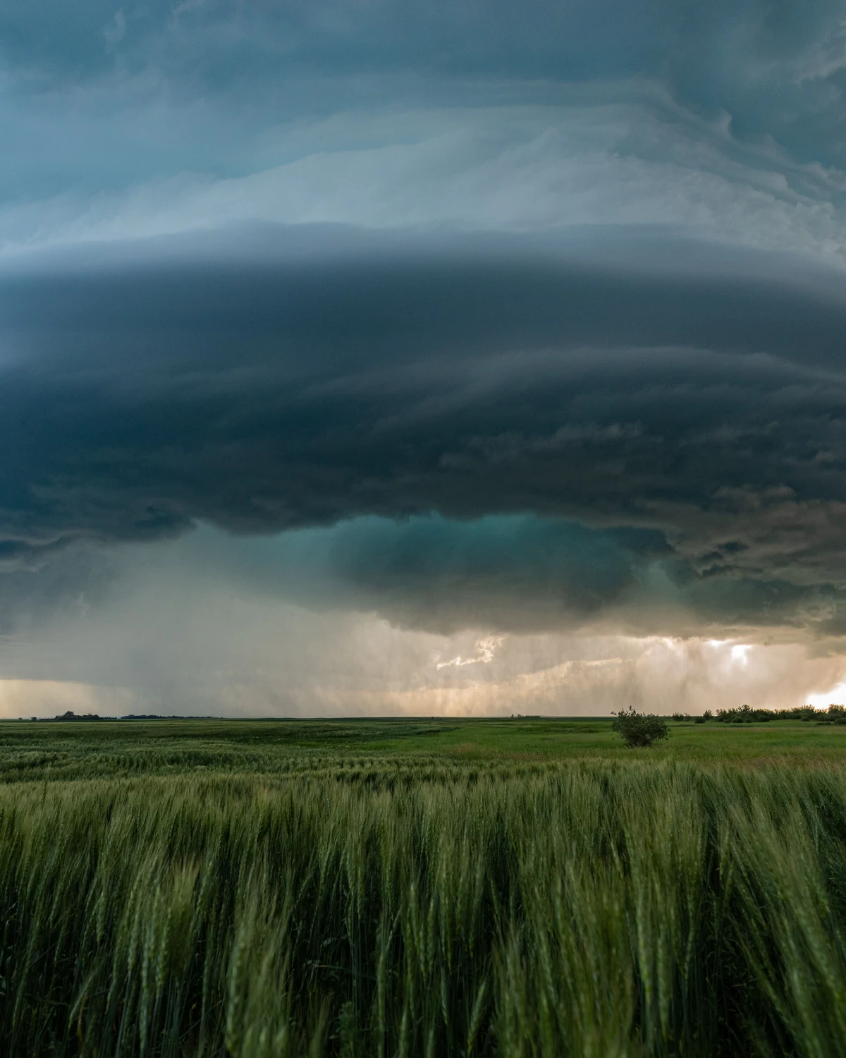
As rotating air accelerates, pressure can fall. Cooling associated with expansion may bring moist air to saturation, forming a visible condensation funnel. The visible boundary marks where droplets survive, not the full wind field.
A tornado is defined by a violently rotating column of air in contact with the ground and pendant from a cumuliform cloud. It can be present before a condensation funnel reaches the surface; dust and debris may reveal ground contact. Conversely, a funnel cloud aloft is not a tornado until the circulation reaches the ground.
Rain wrapping, darkness and terrain can hide the funnel. Visual absence is not safety evidence, and a photograph cannot establish wind intensity.
Not every tornado comes from a classic supercell
Supercells produce many significant tornadoes and provide the clearest research framework, but tornadoes also occur with quasi-linear convective systems, tropical-cyclone rainbands and smaller storms. Landspouts can develop from vertical vorticity along a boundary stretched by a growing updraft without a deep mesocyclone like a classic supercell.
Waterspouts include fair-weather types and tornadic types. The surface—land or water—does not supply a special suction fluid. The rotating air and pressure field are atmospheric.
Any explainer that makes a hook-echo supercell mandatory for every tornado excludes real events. This article focuses on the supercell pathway while naming the boundary.
Why two similar supercells diverge
Storms ingest different near-surface air. Small differences in temperature, humidity and wind along boundaries change buoyancy and vorticity. Precipitation changes downdraft cooling. The low-level updraft can pulse. Internal waves and mergers reposition rotation.
Dawson and colleagues created ensembles of simulations based on VORTEX2 environments. Small perturbations produced tornadic and nontornadic outcomes, demonstrating volatility: favorable environments can host storm-internal differences with large consequences.
This does not mean tornadoes are random. It means predictability is limited by sensitive, multiscale evolution and incomplete observations. Probabilistic forecasts and warnings communicate risk more honestly than a deterministic checklist.
VORTEX turned storm chasing into coordinated measurement
The original Verification of the Origins of Rotation in Tornadoes Experiment in 1994–95 deployed mobile Doppler radars, instrumented vehicles, aircraft and surface teams around targeted storms. It documented a tornado life cycle and shifted attention toward near-surface outflow and rear-flank processes.
VORTEX2 in 2009–10 expanded the fleet and sampling. Later VORTEX-SE and projects such as TORUS and PERiLS addressed different regions, storm modes and warning problems. The human work is logistical as much as theoretical: place instruments around a hazardous moving target without making data collection the hazard.
Field projects also reveal sampling bias. Teams may miss the crucial small region, road networks constrain placement, and probes measure a moving storm at different times. One spectacular intercept does not define every tornado.
Parcel trajectories replace the descending-tube cartoon
High-resolution simulations release numerical tracers and follow air parcels backward from the developing vortex. Researchers can ask whether a parcel entered through warm inflow, descended through precipitation, acquired baroclinic vorticity or passed around a pressure perturbation before rising near the tornado.
The method is powerful but model-dependent. Microphysics determines evaporation and cooling; grid spacing limits the smallest eddies; surface drag is parameterized; a simulated storm is initialized from an idealized or imperfectly observed environment. Agreement with radar structure does not prove every parcel path occurred in nature.
Field data and simulation therefore test each other. Observed thermodynamic probes constrain cold-pool properties; radar constrains flow; simulations expose a three-dimensional budget that instruments cannot sample everywhere. The strongest inference is a mechanism recurring across cases and methods, with failed cases retained for comparison.
Formation and maintenance are different questions
The conditions that intensify the first ground circulation need not be those that keep a mature tornado strong. Once formed, the vortex changes pressure, inflow, debris loading and friction near the surface. Multiple suction vortices can orbit within a larger circulation. The parent mesocyclone and downdraft continue evolving.
A study that explains tornadogenesis may not predict duration, width or peak wind. Likewise, a damage pattern after maturity cannot reveal the exact first parcel sequence. Separating initiation, intensification, maintenance and decay prevents one dramatic case from becoming a universal life cycle.
Radar sees motion indirectly
Doppler weather radar measures the component of target motion toward or away from the radar. Adjacent inbound and outbound velocities can indicate rotation. At long range, the beam is higher and broader, so near-ground details may be unresolved.
A tornado vortex signature is a compact velocity pattern associated with strong rotation, but beam geometry, debris and sampling affect interpretation. Dual-polarization radar can detect lofted debris through a tornado debris signature, often confirming damaging circulation rather than predicting its first formation.
Radar warnings combine environment, storm history, velocity, reflectivity, debris evidence and trained judgment. A public radar screenshot is not a self-issued all-clear.
The EF scale measures damage, not wind directly
After a tornado, survey teams examine damage indicators and degrees of damage to estimate wind-speed ranges on the Enhanced Fujita scale. Construction quality, available structures and debris affect the estimate. A violent tornado over open land can leave fewer indicators than one crossing a built area.
Mobile Doppler radar can measure winds above ground but has its own sampling geometry. In-situ probes are rarely in the strongest part and can be damaged. No single measurement gives a complete three-dimensional near-surface wind field.
Therefore “EF rating caused the formation” is category confusion. The rating is a post-event damage estimate, not a tornado type or forecast intensity label.
Pressure is part of the vortex, not the house myth
Strong rotation requires an inward pressure-gradient force to curve fast-moving air. Pressure generally decreases toward the core, but tornado damage comes primarily from extreme winds and wind-borne debris, with pressure change contributing loads.
Opening windows does not equalize a home safely and wastes shelter time. NWS guidance directs people to a basement or small interior room on the lowest floor, away from windows, while protecting the head. Manufactured-home occupants need a planned sturdy shelter.
The “exploding house” story survives because pressure is invisible. Engineering evidence makes wind and debris the practical priority.
A wall cloud is context, not a prediction
A lowered cloud base beneath a rain-free updraft can form a wall cloud. Rotation, rapid motion and persistent organization may concern trained spotters. Scud clouds—ragged fragments in moist inflow—can look like funnels without organized rotation.
No visual checklist lets an untrained observer distinguish every dangerous circulation, especially at night or in heavy rain. Do not approach, stop under an overpass or stand outside filming. Official warnings, NOAA Weather Radio and local emergency guidance are the action sources.
Storm spotters are trained to observe from planned safe positions and report to forecast offices. Their reports complement radar; they are not entertainment instructions.
Tornado warnings are decisions under uncertainty
A tornado watch means the environment supports tornado potential across a region and time window. A warning means a tornado is indicated by radar or reported and immediate protective action is needed in the warned area. Exact wording and systems vary by country.
Warnings can precede visible ground contact, arrive after rapid formation or sometimes verify without a tornado. False alarms and misses reflect an asymmetric decision: failing to warn a real tornado can be catastrophic, while warning uncertain circulation has costs.
No photograph, and no article, can grade a warning that is live where you are standing. Use official local information and act on it.
What scientists know—and what they are still chasing
We know how environmental shear supports rotating updrafts and how stretching intensifies existing vorticity. We know downdrafts and near-ground baroclinic zones are crucial in many supercell tornadoes. Radar and field observations document recurring sequences.
We do not have one deterministic chain that maps every mesocyclone to tornado or failure. The sources of near-ground vorticity can differ; microphysical cooling and pressure forces interact; the decisive structures are small and transient. Nonsupercell tornadoes require related but distinct accounts.
The honest answer is a conditional mechanism, not an unfinished shrug.
The last hundred meters change the story
High above, the storm has already solved the easier problem: organize rotation inside a sustained updraft. At the surface it must assemble vorticity without passing through the ground, keep air liftable despite rain-cooled outflow, converge the right parcels and stretch their rotation faster than friction and mixing disperse it.
Sometimes that alignment persists and a compact vortex forms. Sometimes the cold pool races ahead, the updraft weakens or rotation remains broad. Two radar images can look similar while parcel histories differ.
A tornado is the moment storm-scale organization becomes ground-level concentration. Understanding that boundary is why researchers keep surrounding supercells with instruments—and why everyone else should move away from the window.
Frequently asked questions
Do tornadoes form from the ground up or cloud down?
Observations show intensification can evolve at several levels, and visible funnels can descend while ground circulation strengthens. One universal direction is too simple; near-ground vorticity and stretching are essential.
Does every supercell make a tornado?
No. Many rotating supercells never produce one. Near-surface thermodynamics, downdrafts, boundaries and internal evolution help determine the outcome.
Is a funnel cloud always a tornado?
No. A funnel is condensed cloud associated with rotation aloft. A tornado requires rotating air in contact with the ground; debris can reveal contact before condensation does.
Can tornadoes form without supercells?
Yes. Landspouts, some line-embedded tornadoes and tropical-cyclone tornadoes can follow different storm-scale pathways.
Why does stretching make rotation faster?
Convergence reduces the radius of circulating air while vertical stretching increases vorticity. An ideal circulation example gives speed inversely proportional to radius, but real tornadoes are open, turbulent systems.
Can hills or rivers stop a tornado?
No dependable terrain feature stops tornadoes. Terrain may influence near-surface flow, but tornadoes cross hills, rivers and cities. Follow warnings rather than folklore.
Should you open windows?
No. It delays shelter and exposes people to debris. Go to the lowest available interior room, away from windows, following local official guidance.
Can radar predict the exact moment a tornado forms?
Radar identifies rotation and debris signatures, but beam limits and rapid near-ground evolution prevent exact universal prediction. Warnings combine multiple sources and expert judgment.
Sources & further reading
This explainer was prepared through desk research using the sources below; established findings are distinguished from open questions in the text. See our editorial methodology.
- NOAA National Severe Storms Laboratory, Severe Weather 101: Tornado Basics and Types — supercell rotation, tornado definitions and nonsupercell types.
- NOAA NSSL, VORTEX2 Background and Science — field-project design, rear-flank findings, nontornadic mesocyclones and open research questions.
- Markowski & Richardson, “Tornadogenesis: Our current understanding, forecasting considerations, and questions to guide future research,” Atmospheric Research 93 (2009) — mesocyclogenesis, near-ground vorticity and downdraft requirement/framework.
- Davies-Jones, “A review of supercell and tornado dynamics,” Atmospheric Research 158–159 (2015) — staged development of the midlevel mesocyclone, near-ground rotation and tornado spin-up, including unresolved failure pathways.
- Dawson et al., “Volatility of Tornadogenesis: An Ensemble of Simulated Nontornadic and Tornadic Supercells in VORTEX2 Environments,” Monthly Weather Review 145 (2017) — sensitivity of tornadic outcomes to small storm/environment perturbations.
- Orf et al., “Evolution of a Long-Track Violent Tornado within a Simulated Supercell,” Bulletin of the American Meteorological Society 98 (2017) — high-resolution parcel trajectories and storm-scale processes in one simulated case.
- National Weather Service, Tornado Safety — watch/warning meaning and official protective actions.
- NWS, Weather Spotter's Field Guide — observational terminology and the boundary between trained reporting and personal inference.
- NOAA, Enhanced Fujita Scale — damage-indicator basis and post-event intensity estimation.
Spotted an error? We correct verified mistakes promptly — email contact@flashscience.org.
Continue exploring